CHCNAV AlphaAir 15
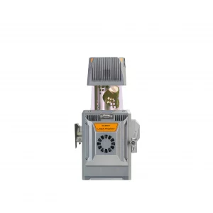
The AlphaAir 15 is a lightweight, high-performance airborne LiDAR system ideal for capturing high-density data over large areas.
Showing all 5 results

The AlphaAir 15 is a lightweight, high-performance airborne LiDAR system ideal for capturing high-density data over large areas.
The AlphaUni 20 is a premium-class mobile LiDAR system, designed for maximum versatility and cost optimization.
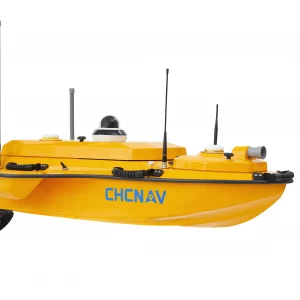
The CHCNAV APACHE 4 is an Unmanned Surface Vehicle (USV) designed for hydrographic and bathymetric surveys, ideal for rivers, lakes, and shallow coastal areas.
Portable LiDAR SLAM scanner with integrated RTK GNSS. 5 cm accuracy outdoors and indoors without additional georeferencing. Available in Spain with technical support in Spanish.
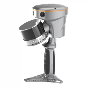
The RS10 is the only handheld scanner on the market that combines a survey-grade GNSS RTK receiver, multi-line LiDAR, and visual SLAM in a single device. It works seamlessly between outdoor and indoor environments with no interruptions or additional georeferencing steps. Official distributor for Spain and Portugal.

The X500 It is a high-performance multirotor drone designed for professional surveying, mapping, inspection, and emergency work.